Where the streets have my name
A playful web tool that maps where your name and your partner’s intersect on real Australian streets.
Overview
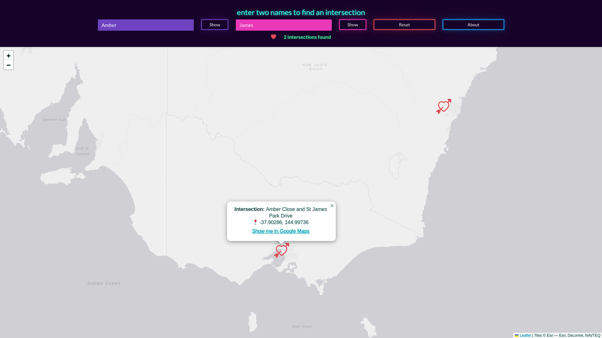
Driven by curiosity around names intersecting on street corners, I developed a data-intensive project exploring whether your name and your partner’s name appear together on streets somewhere in Australia. The project involved large-scale geospatial data processing and visualization to reveal surprising name intersections across the country
Responsibility
I set up a local, Dockerised OpenStreetMap Overpass API instance limited to Australia to avoid rate limiting and manage data size. I gathered and curated name data from various sources, including Victoria’s Births, Deaths, and Marriages registry, focusing on the 1,000 most popular names. I pre-processed extensive geospatial matches between names and street features (processing took about 40 minutes on a modern CPU) and developed a lightweight web tool using Leaflet, integrating GeoJSON datasets (~300MB) and client-side intersection calculations with Turf.js to enable interactive exploration.
Outcome
The resulting web tool allows users to quickly discover if and where their names intersect on Australian streets with a few clicks. It has generated engagement and curiosity around names and places, showcasing a creative application of open data and spatial analysis for a fun and meaningful user experience.