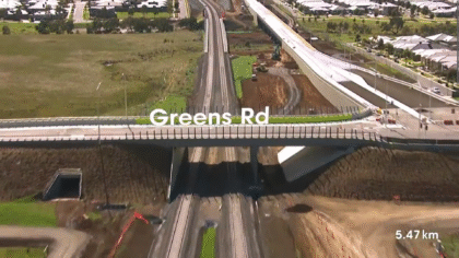
Regional Rail Link – Progress Flyovers
Geospatially accurate animated flyovers that provided clear, timely construction updates for stakeholders over the life of the project.
Geospatially accurate animated flyovers that provided clear, timely construction updates for stakeholders over the life of the project.
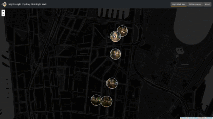
An interactive platform combining lighting data and virtual walkthroughs to capture how people experience urban spaces after dark.
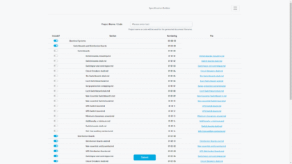
A modular tool that streamlines and standardises engineering specifications across large infrastructure projects.
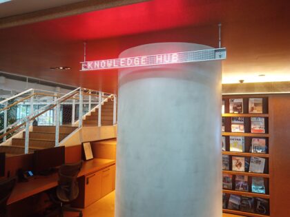
Redesigned and upgraded office LED signage with a user-friendly, LoRA-based system for reliable, multi-floor wayfinding control.
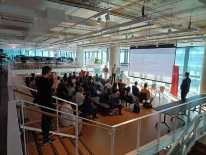
A cross-sector hackathon uniting data and design to prototype solutions for pressing urban challenges.
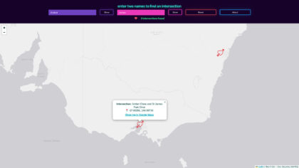
A playful web tool that maps where your name and your partner’s intersect on real Australian streets.
An opt-in tool to help colleagues connect in person during COVID by finding nearby team members.
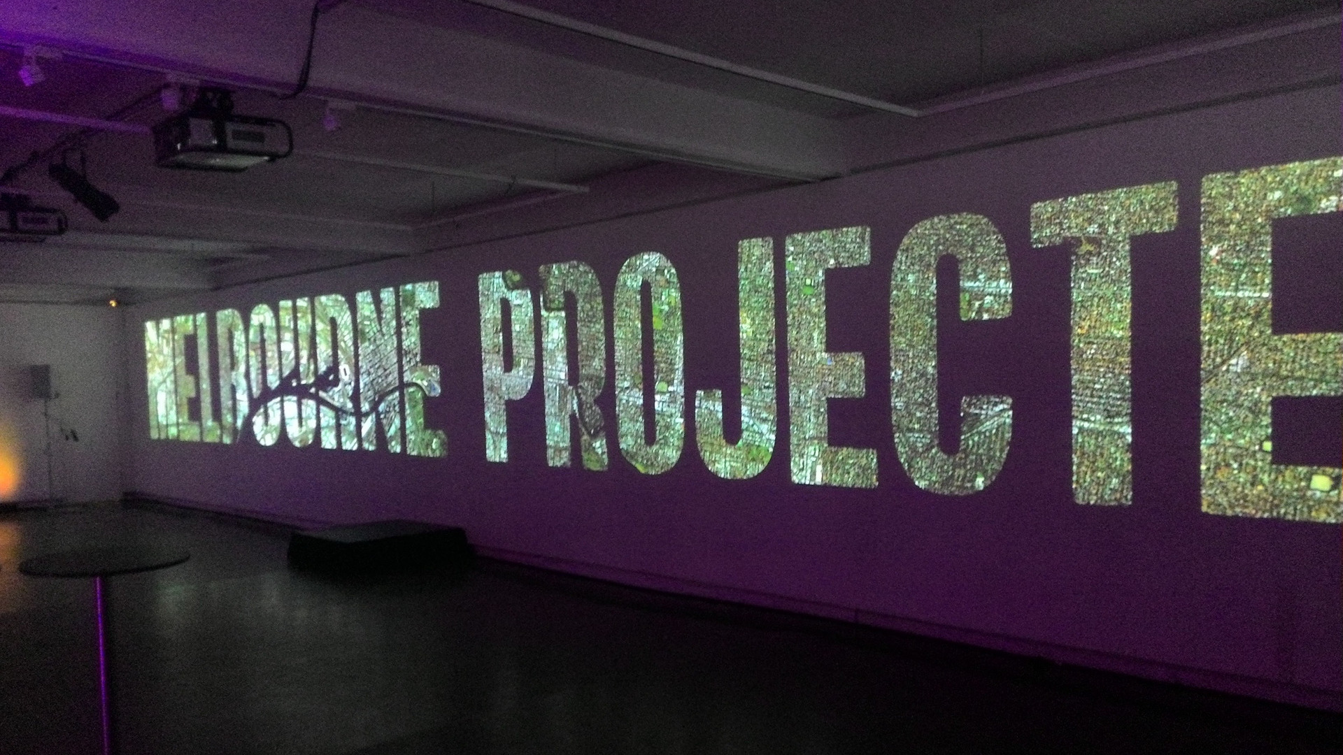
10×2.5m projection for a client event.
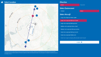
An interactive installation using immersive soundscapes to help communities understand and respond to aircraft noise impacts.
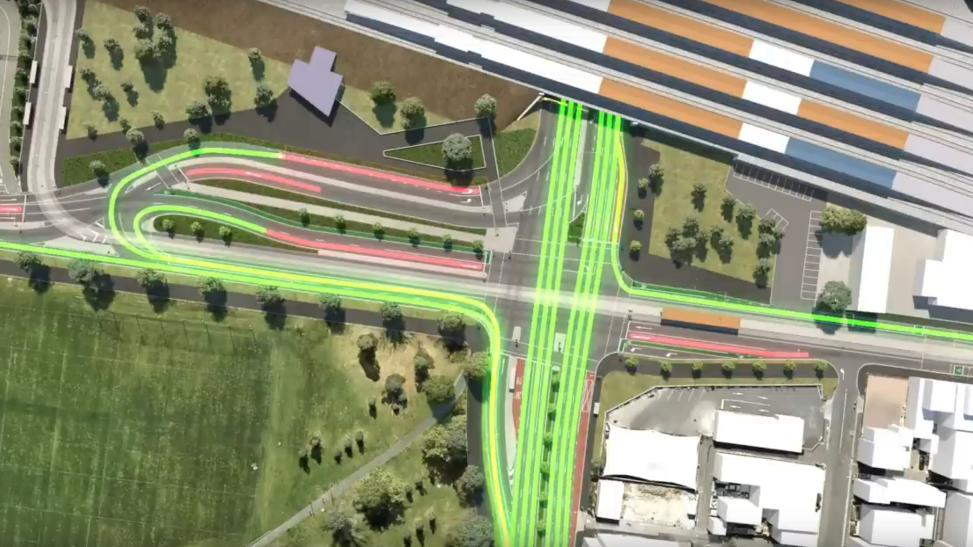
Animated video translating complex transport upgrades into a clear, engaging story for public consultation.
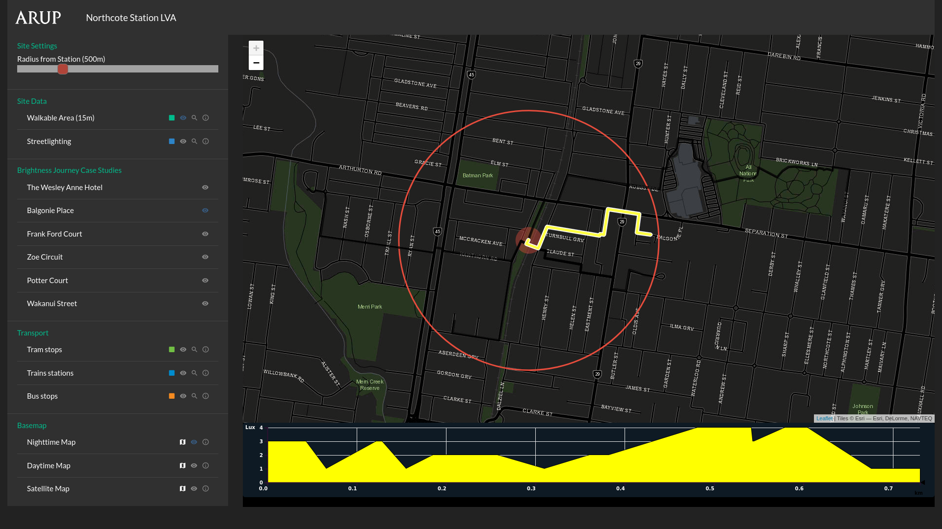
Tool that maps streetlight brightness across a walkable route.
An interactive installation that collects public opinions on urban issues through binary questions in city spaces.
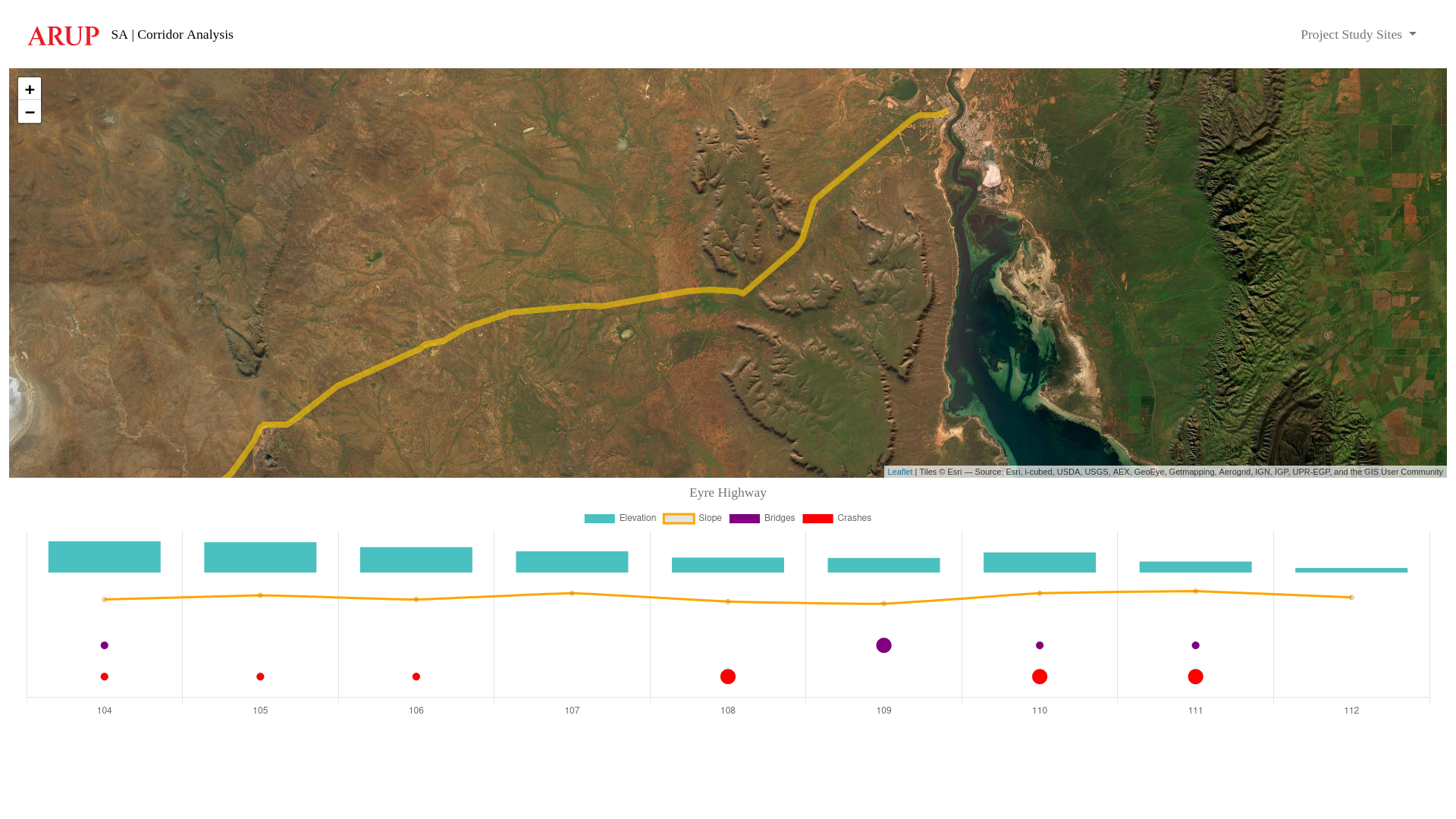
Spatial tool that visualises an existing (or proposed) road corridor, including data for elevation, slope, bridges and vehicle accident/crash locations.
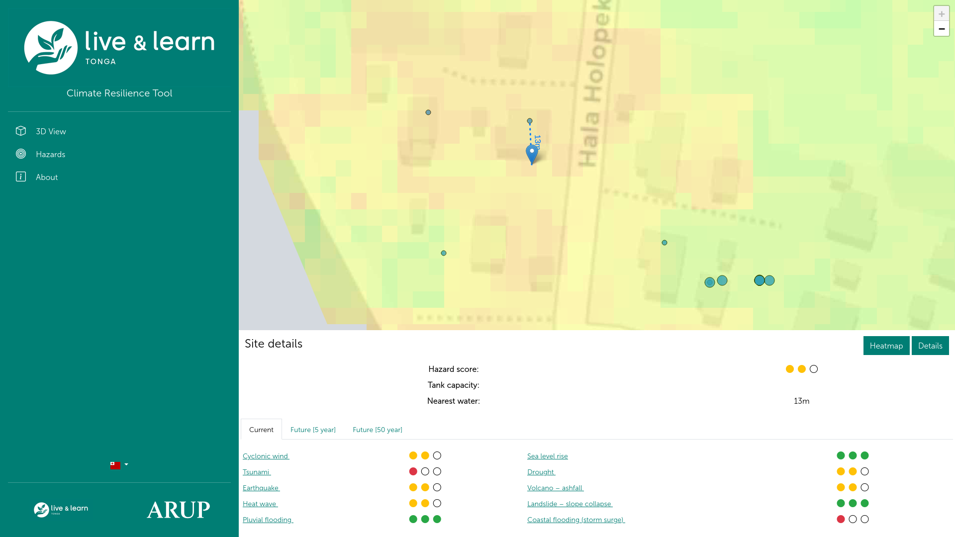
Tool to assist remote communities plan for new water assets.
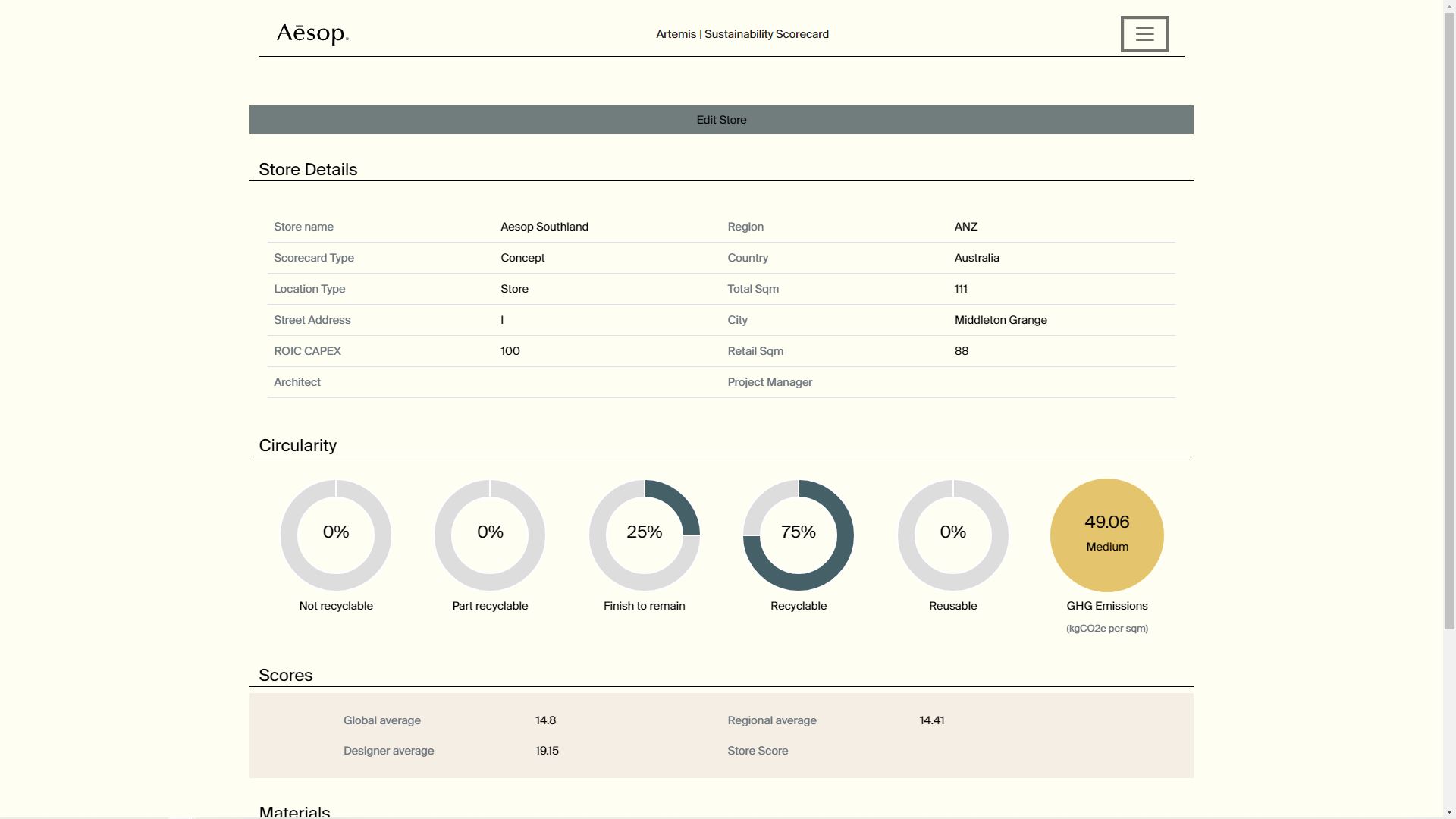
Tool to calculate and track carbon and GHG emissions through a project (store) lifecycle.