Night Insight
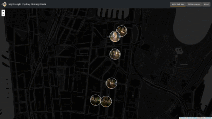
An interactive platform combining lighting data and virtual walkthroughs to capture how people experience urban spaces after dark.
An interactive platform combining lighting data and virtual walkthroughs to capture how people experience urban spaces after dark.
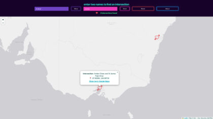
A playful web tool that maps where your name and your partner’s intersect on real Australian streets.
An opt-in tool to help colleagues connect in person during COVID by finding nearby team members.
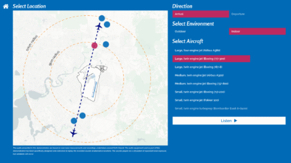
An interactive installation using immersive soundscapes to help communities understand and respond to aircraft noise impacts.
An interactive installation that collects public opinions on urban issues through binary questions in city spaces.
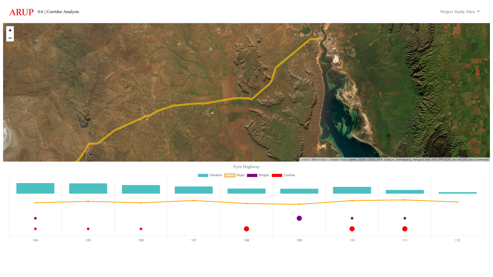
Spatial tool that visualises an existing (or proposed) road corridor, including data for elevation, slope, bridges and vehicle accident/crash locations.
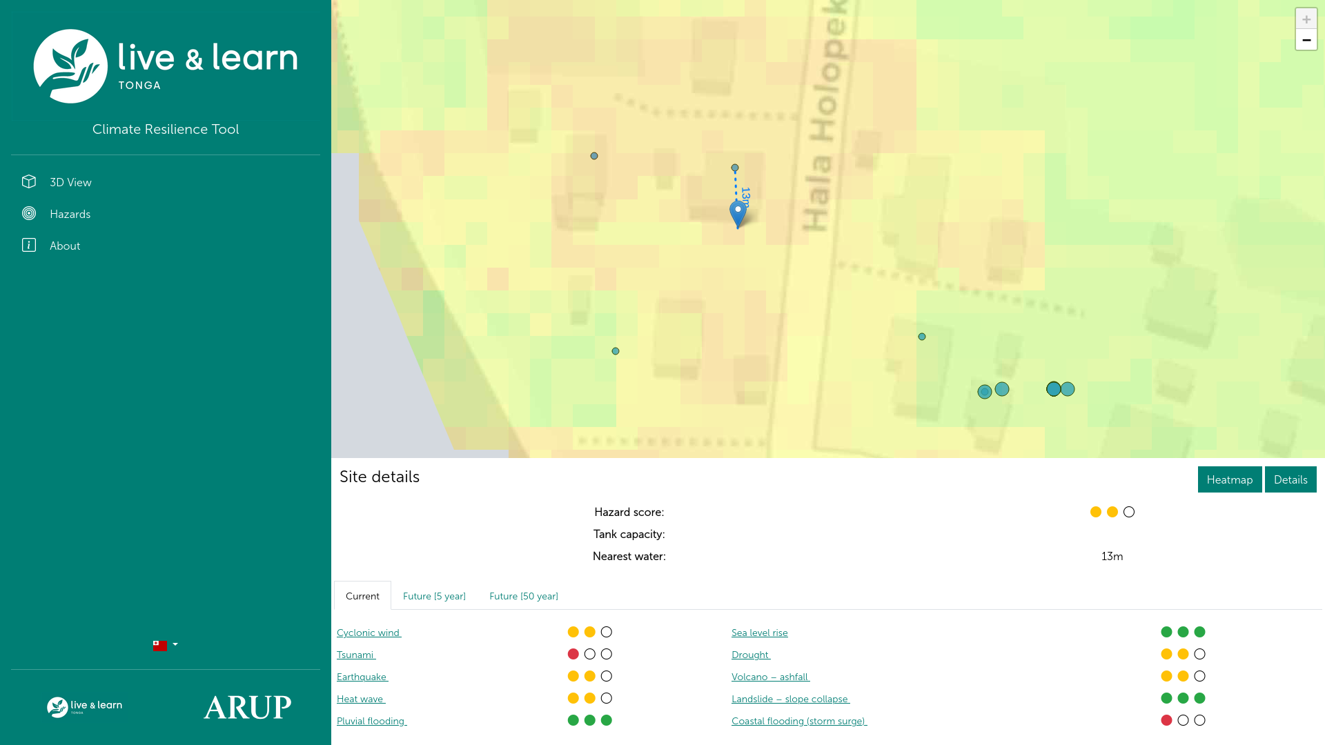
Tool to assist remote communities plan for new water assets.
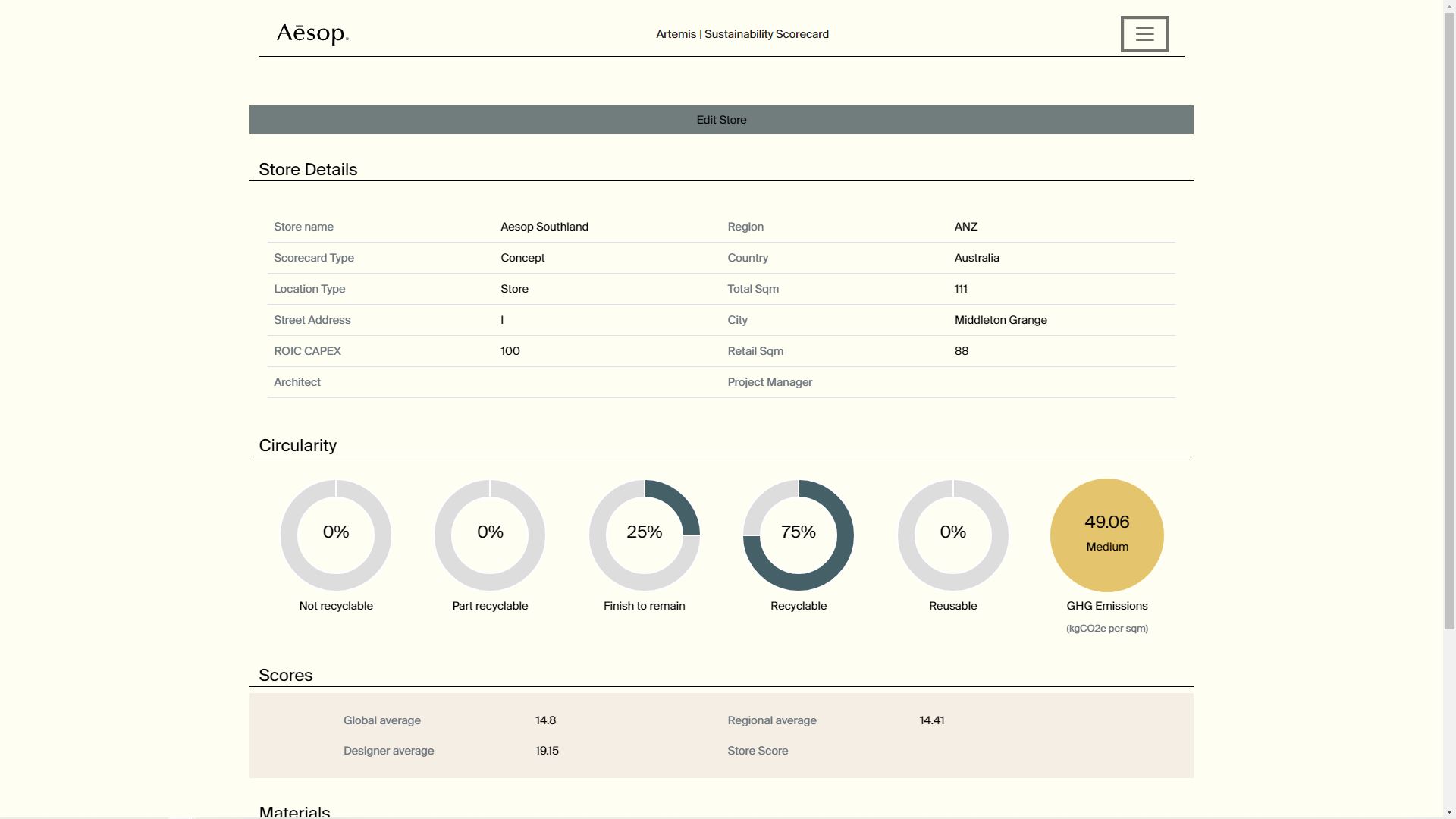
Tool to calculate and track carbon and GHG emissions through a project (store) lifecycle.