South Australia – Corridor Analysis
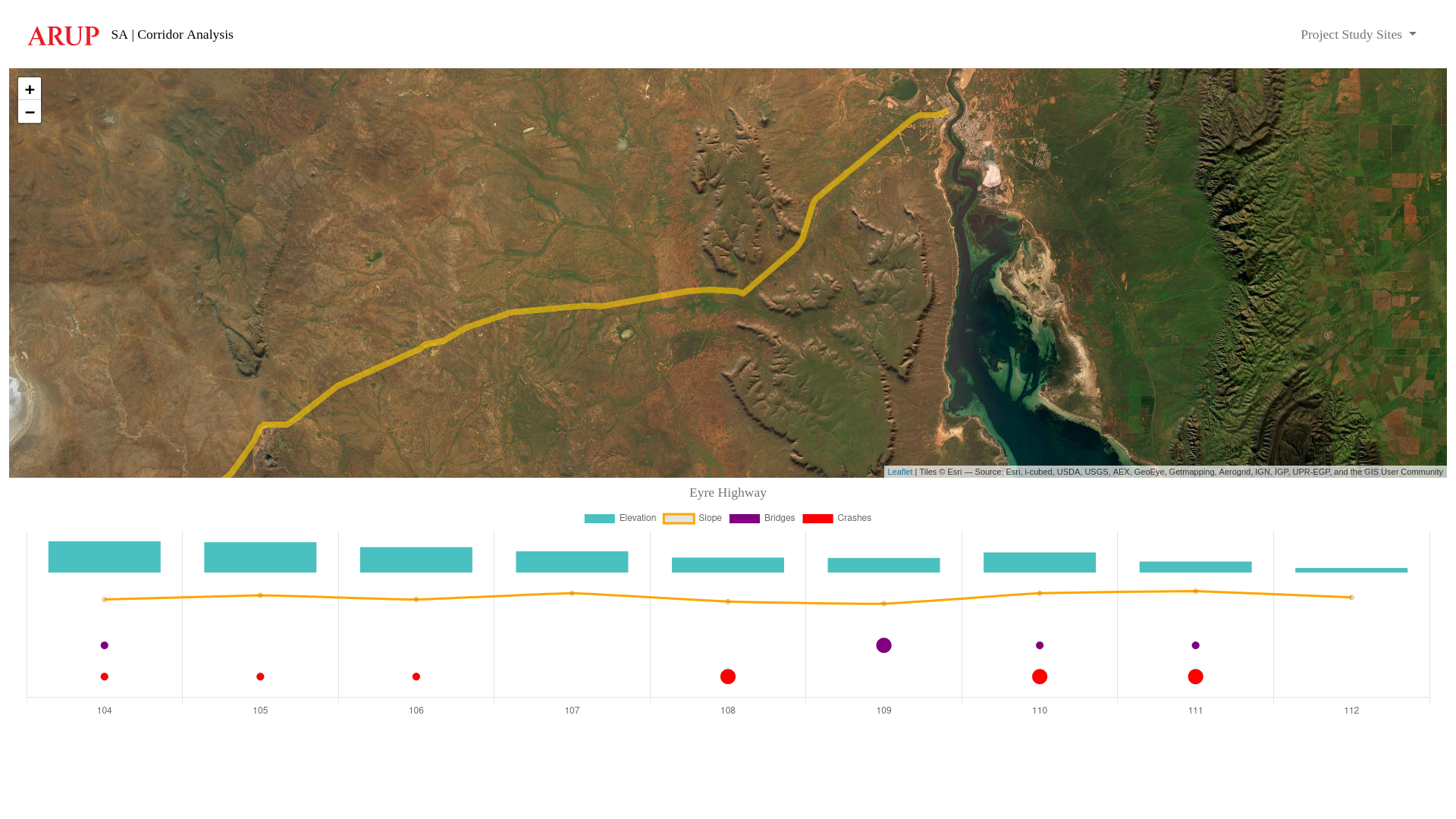
Spatial tool that visualises an existing (or proposed) road corridor, including data for elevation, slope, bridges and vehicle accident/crash locations.
Spatial tool that visualises an existing (or proposed) road corridor, including data for elevation, slope, bridges and vehicle accident/crash locations.