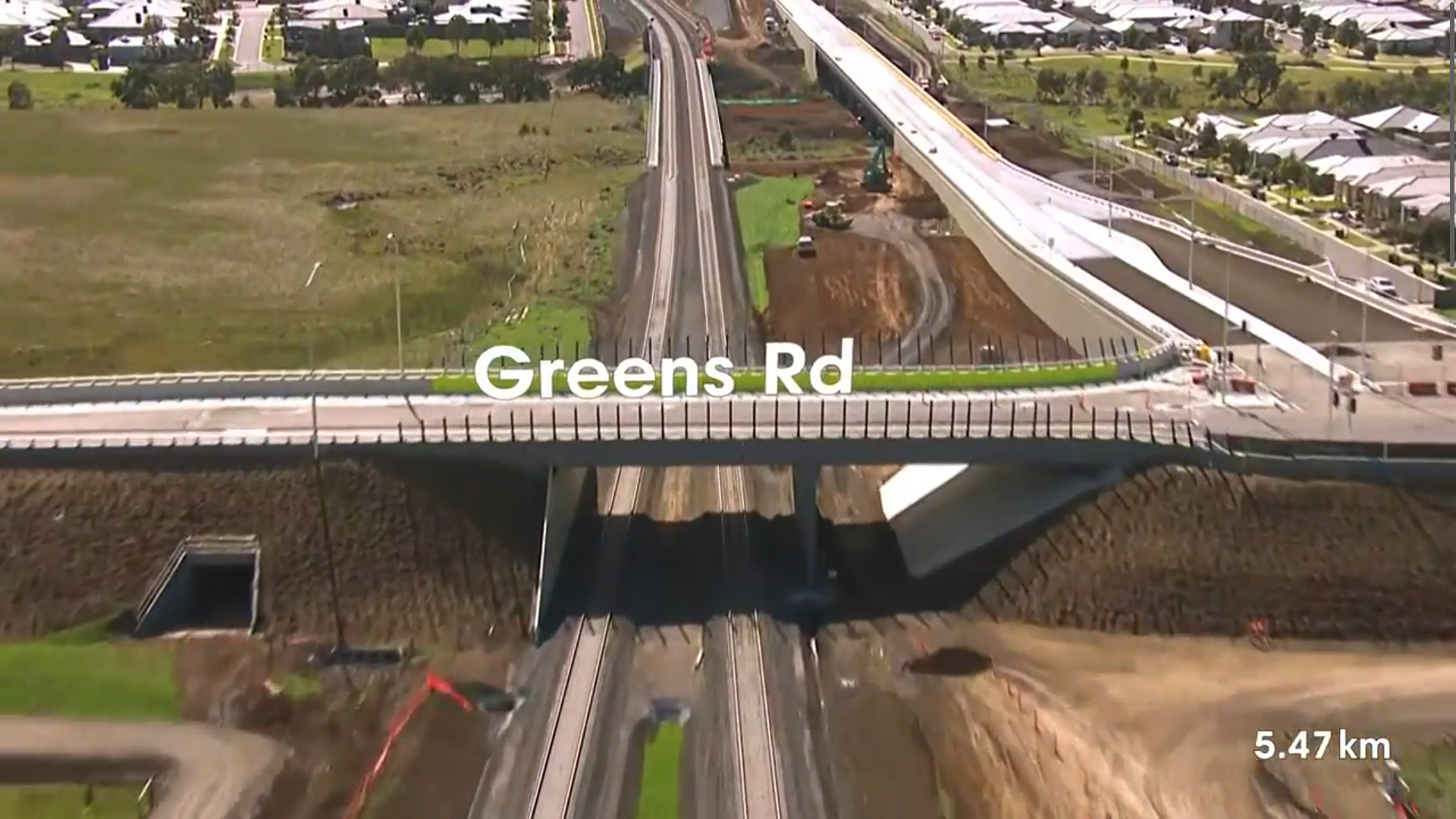
Regional Rail Link – Progress Flyovers
Geospatially accurate animated flyovers that provided clear, timely construction updates for stakeholders over the life of the project.
Overview:
As part of stakeholder engagement for the Regional Rail Link project, there was a need to provide regular, high-quality visual updates of construction progress to both internal teams and external partners. These updates needed to be clear, timely, and geospatially accurate.
Responsibility:
I developed and implemented a method to integrate monthly aerial flyovers into stakeholder presentations. This involved coordinating with internal and external consultants to gather and align geospatial data and drone video footage. I created automated workflows using JavaScript and advanced video compositing techniques to streamline the generation of these animated progress updates.
Outcome:
Over a two-year period, I reduced the production timeline from five days to just one day per update. This significant efficiency gain not only improved delivery cadence but also contributed directly to increased project profitability.