Lighting Vulnerability Assessment – Brightness Journey Tool
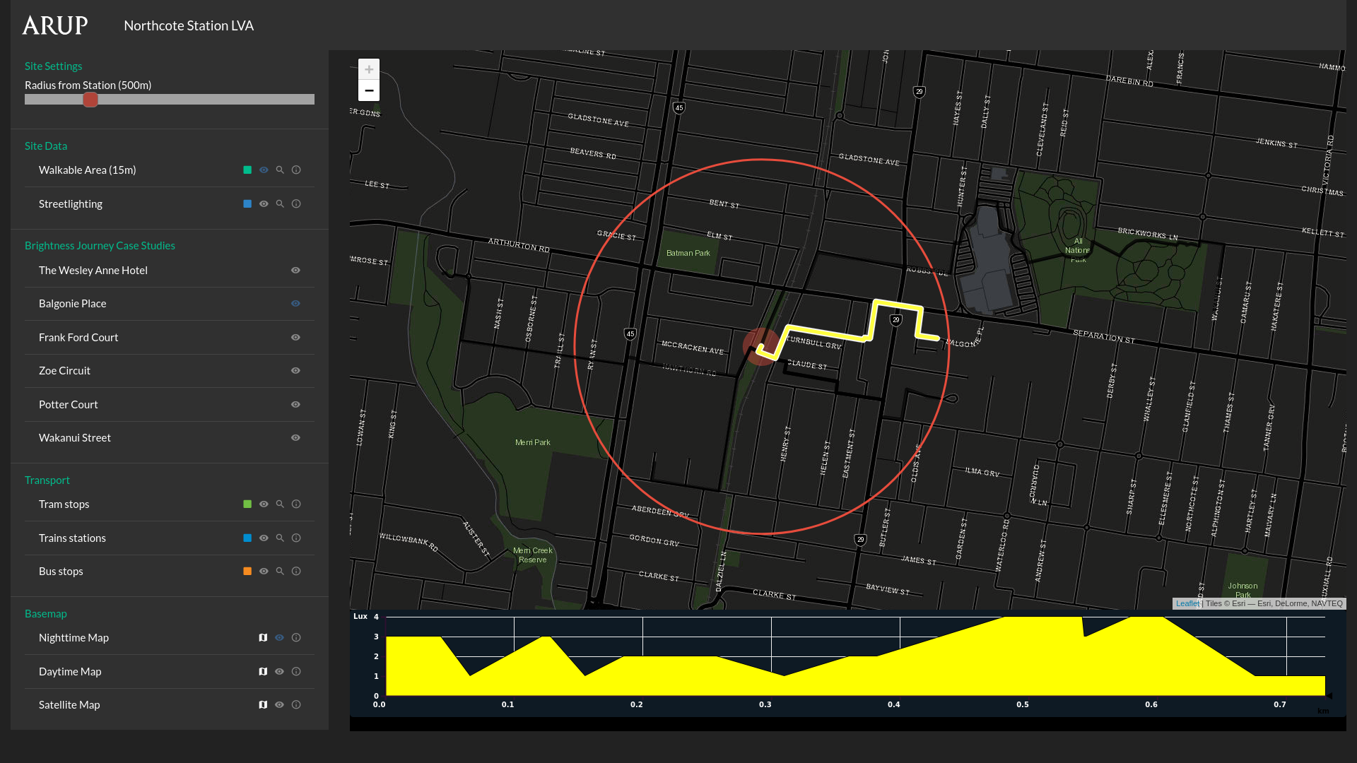
Tool that maps streetlight brightness across a walkable route.
Tool that maps streetlight brightness across a walkable route.
An interactive installation that collects public opinions on urban issues through binary questions in city spaces.
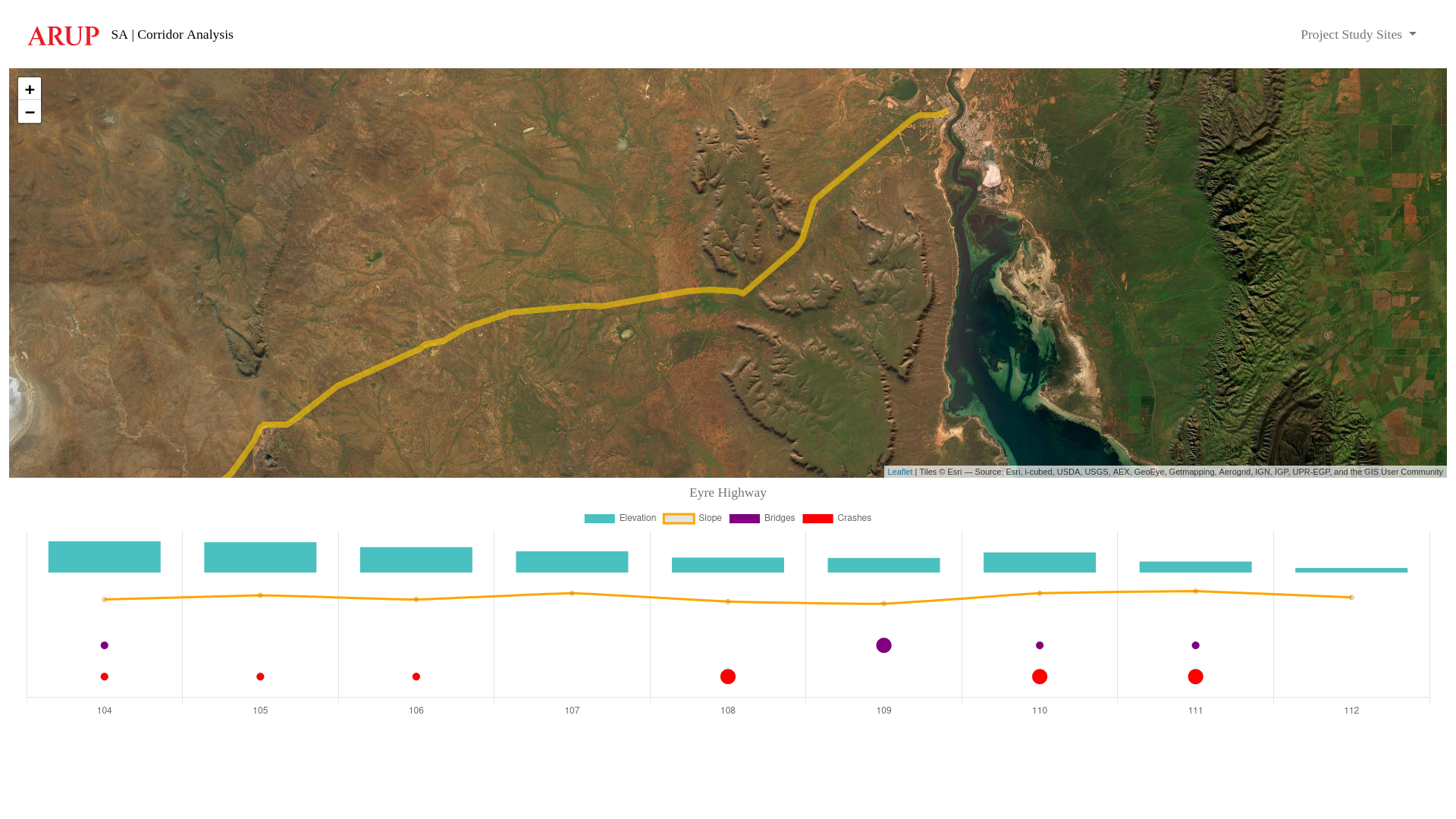
Spatial tool that visualises an existing (or proposed) road corridor, including data for elevation, slope, bridges and vehicle accident/crash locations.
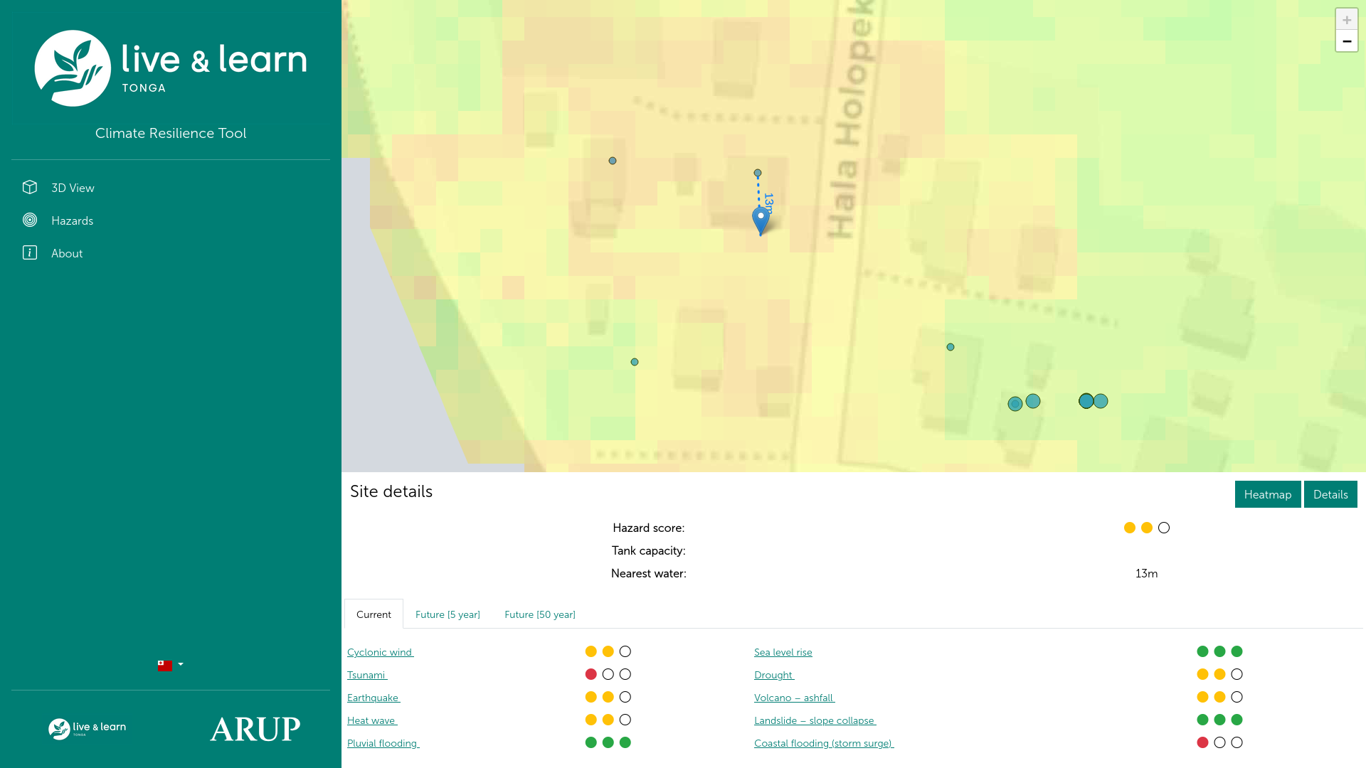
Tool to assist remote communities plan for new water assets.
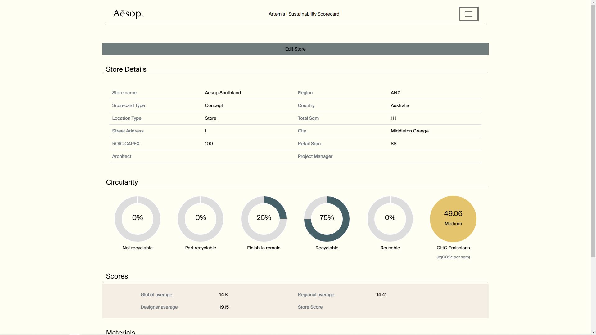
Tool to calculate and track carbon and GHG emissions through a project (store) lifecycle.