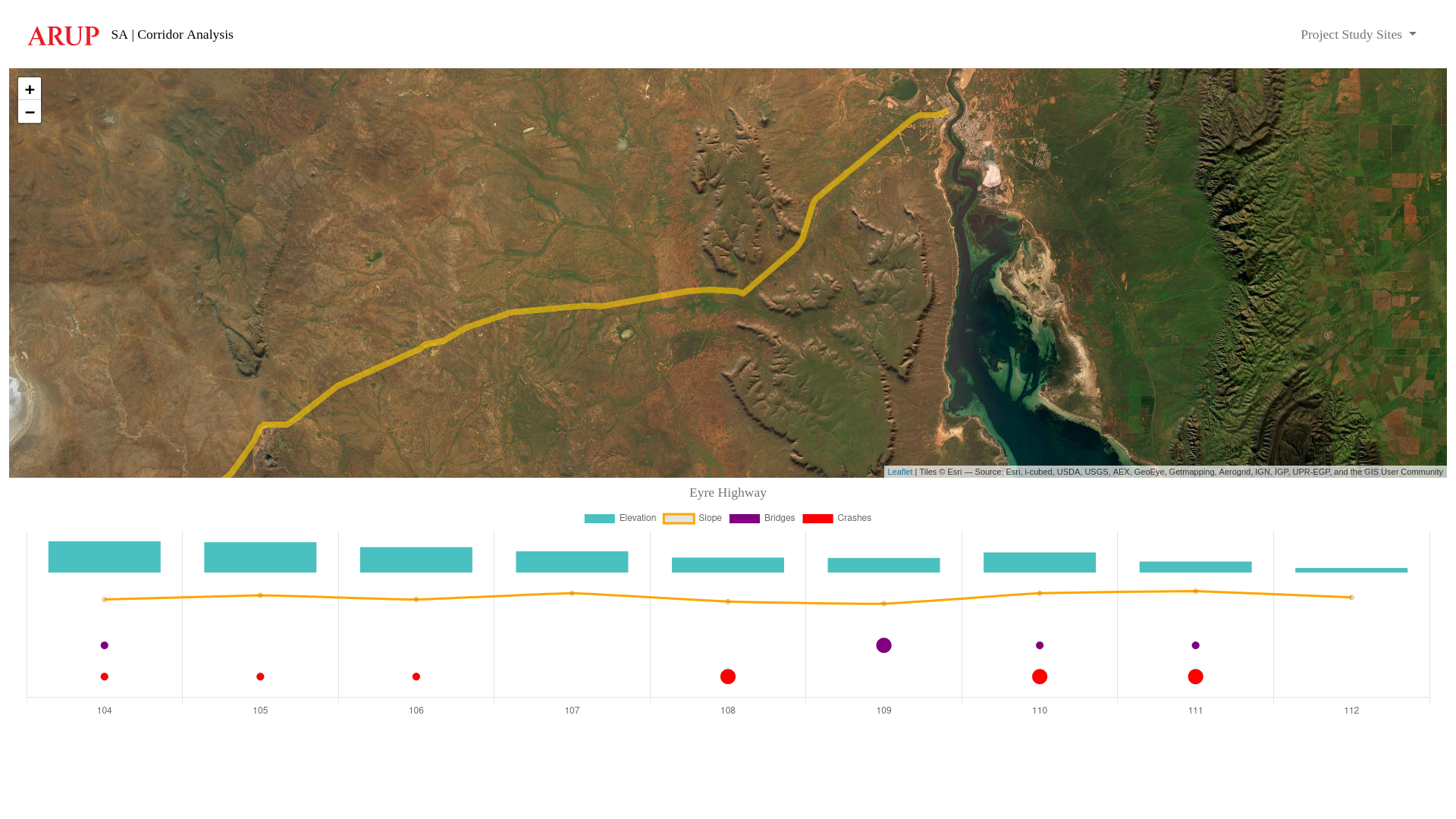
South Australia – Corridor Analysis
Spatial tool that visualises an existing (or proposed) road corridor, including data for elevation, slope, bridges and vehicle accident/crash locations.
Overview:
In South Australia, local councils needed a consistent and data-driven way to assess and plan safe, climate-resilient road corridors. Road design decisions were often fragmented, lacking integration of key geospatial data such as crash history, slope, elevation, and projected climate impacts.
Responsibilities:
I developed the South Australian Risk Corridor Assessment Tool (SA-RCAT), a custom web application that enables planners to visualise and assess road safety factors in a unified spatial interface. The tool aggregates data on historical vehicle accidents, terrain, and overpass impact risk, helping users identify priority areas and make more informed design decisions.
Outcome:
The SA-RCAT was used by road authorities across South Australia to standardise corridor assessments. It enhances road safety, supports resilient infrastructure planning, and contributes to more transparent, evidence-based decision-making in the built environment.