Live and Learn Tonga – Climate Tool
Tool to assist remote communities plan for new water assets.
Overview:
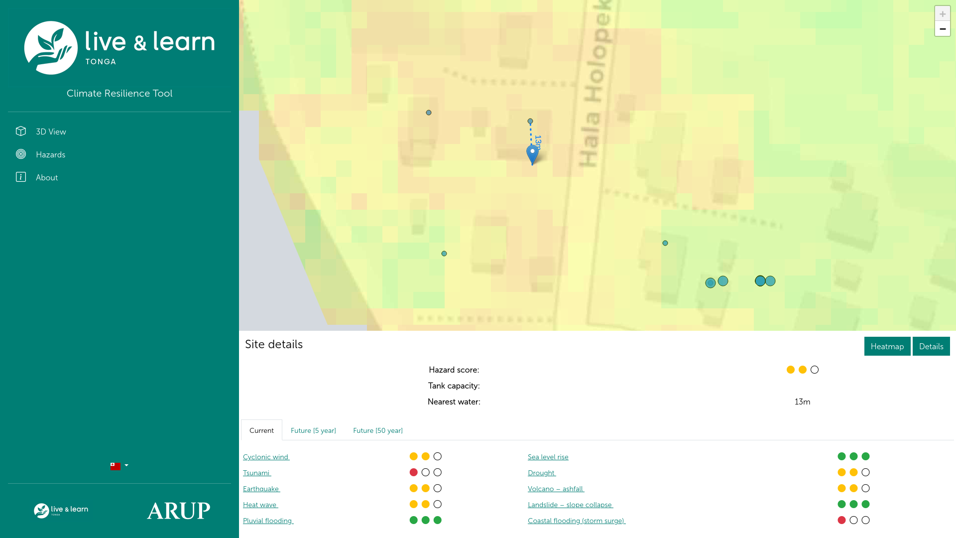
Communities in Tonga, such as Holopeka village, face increasing challenges in planning resilient infrastructure—particularly water storage—due to the impacts of climate change. There was a need for a locally relevant, easy-to-use planning tool that could work offline, be understood with minimal training, and communicate climate risk in a visual, culturally appropriate way.
Responsibility:
I developed an interactive spatial web map that overlays climate risk data with geographic and infrastructure layers to assess the suitability of proposed water storage sites. Built as a Progressive Web App, the tool allows residents to visualise risk exposure, model future scenarios, and make data-informed decisions during asset planning and design. To ensure accessibility and community ownership, I included bilingual support (Lea Faka-Tonga), offline functionality, and a simple traffic light system to communicate risk levels. The solution was tailored in close consultation with Live and Learn’s Tonga office and designed with minimal technical complexity to support future local maintenance and development.
Outcome:
The tool is still actively used by the Holopeka community, supporting informed, climate-resilient decision-making for critical water infrastructure. By aligning with local needs and capacities, it strengthens the built environment in a vulnerable region through accessible technology and participatory planning.